


Franche-Comte - Michelin Regional Map 520
Map
Seiten
2016
|
2020
Michelin Editions des Voyages (Verlag)
978-2-06-720921-3 (ISBN)
Michelin Editions des Voyages (Verlag)
978-2-06-720921-3 (ISBN)
- Titel erscheint in neuer Auflage
- Artikel merken
Zu diesem Artikel existiert eine Nachauflage
With MICHELIN Regional Maps, find more than just your way! In addition to Michelin's clear and accurate mapping, the regional map series includes all the practical information for a trouble free journey, including major town plans as well as tourism information to make the most of your journey. Scales from 1:150,000 to 1:2,400,000
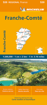
(Edition revised in 2020) MICHELIN Franche-Comt‚ Regional Map scale 1/200,000 will provide you with an extensive coverage of primary, secondary and scenic routes for this French region. In addition to Michelin's clear and accurate mapping, this regional map includes all the practical information for a trouble free journey, including major town plans as well as tourism information to make the most of your journey. With MICHELIN Regional Maps, find more than just your way!
MICHELIN REGIONAL MAPS include practical information for a trouble free journey and show primary & secondary road networks.
* Administrative boundaries
* Scenic routes and tourist sights
* Place name index
* Time and distance charts
* Plans for a selection of major towns
* Practical information: danger alerts, service stations, picnic areas
| Erscheint lt. Verlag | 7.3.2016 |
|---|---|
| Verlagsort | Paris |
| Sprache | englisch |
| Maße | 113 x 250 mm |
| Gewicht | 118 g |
| Themenwelt | Reisen ► Karten / Stadtpläne / Atlanten ► Europa |
| Reiseführer ► Europa ► Frankreich | |
| ISBN-10 | 2-06-720921-3 / 2067209213 |
| ISBN-13 | 978-2-06-720921-3 / 9782067209213 |
| Zustand | Neuware |
| Informationen gemäß Produktsicherheitsverordnung (GPSR) | |
| Haben Sie eine Frage zum Produkt? |
Mehr entdecken
aus dem Bereich

aus dem Bereich