


Collins Dublin Streetfinder Colour Map
2016
|
New edition
Collins (Verlag)
978-0-00-815865-1 (ISBN)
Collins (Verlag)
978-0-00-815865-1 (ISBN)
- Titel erscheint in neuer Auflage
- Artikel merken
Zu diesem Artikel existiert eine Nachauflage
Explore the city of Dublin with this detailed, fully updated colour map. Street by street map covering central Dublin and the surrounding area.
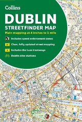
The map, at a scale of 4 inches to 1 mile (1:15,840), has clear, colour-classified streets named and numbered plus places of interest, all fully colour coded for ease of use. It covers the area from Ballymun and Baldoyle in the north to Dundrum in the south, and includes Castleknock and Phoenix Park in the west to the coast in the east. It is ideal for residents, businesses and visitors alike.
The map includes:
• A guide to central Dublin, including information on its history, and travel, transport and shopping
• Full index to street names
• Route planning map of the area around Dublin
• Luas tramways and inner and outer orbital routes
• Important buildings and places of interest
• Car parks and railway stations
• Speed enforcement zones as highlighted by the Garda and the National Roads Authority
• Fixed safety camera locations
Explore the world through accurate and up-to-date mapping.
| Erscheint lt. Verlag | 10.3.2016 |
|---|---|
| Verlagsort | London |
| Sprache | englisch |
| Maße | 140 x 230 mm |
| Gewicht | 120 g |
| Themenwelt | Reisen ► Karten / Stadtpläne / Atlanten ► Europa |
| ISBN-10 | 0-00-815865-7 / 0008158657 |
| ISBN-13 | 978-0-00-815865-1 / 9780008158651 |
| Zustand | Neuware |
| Informationen gemäß Produktsicherheitsverordnung (GPSR) | |
| Haben Sie eine Frage zum Produkt? |
Mehr entdecken
aus dem Bereich


aus dem Bereich
markierte Wanderwege, Hütten, Radrouten
Karte (gefalzt) (2023)
Kompass-Karten (Verlag)
CHF 26,90
Karte (gefalzt) (2024)
Freytag-Berndt und ARTARIA (Verlag)
CHF 18,95