


Motoring Britain
Seiten
2001
|
New edition
Philip's (Verlag)
978-0-540-08034-2 (ISBN)
Philip's (Verlag)
978-0-540-08034-2 (ISBN)
- Titel erscheint in neuer Auflage
- Artikel merken
Zu diesem Artikel existiert eine Nachauflage
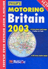
This motoring atlas, at 4 miles to the inch, includes highlighted primary destinations, and extensive tourist information including places of interest on the maps that are highlighted in the index. It also has a multi-language legend.
A new edition of this excellent value atlas featuring fully updated mapping derived from Philip's digital database. This atlas includes features normally encountered only in more expensive road atlases. Available in a convenient and handy A4 paperback format, the atlas offers excellent coverage of Britain at a scale of 4 miles to 1 inch and includes a Northern Ireland section with separate index. The mapping is both clear and detailed, using colours that have been tested for ease of use by atlas buyers. The main features include primary destinations which are highlighted by the Philip's route-finding system and extensive tourist information, including places of interest on the main mapping which are highlighted in the index.
A new edition of this excellent value atlas featuring fully updated mapping derived from Philip's digital database. This atlas includes features normally encountered only in more expensive road atlases. Available in a convenient and handy A4 paperback format, the atlas offers excellent coverage of Britain at a scale of 4 miles to 1 inch and includes a Northern Ireland section with separate index. The mapping is both clear and detailed, using colours that have been tested for ease of use by atlas buyers. The main features include primary destinations which are highlighted by the Philip's route-finding system and extensive tourist information, including places of interest on the main mapping which are highlighted in the index.
ii Key map 2-113 112 pages of main mapping iii Restricted motorway junctions 114-115 2 pages of Northern Ireland mapping iv-v Route planner 116 1 page of Northern vi-vii Multi-language legend/distance table 117-136 Ireland mapping index 20 pages main mapping index
| Erscheint lt. Verlag | 7.8.2001 |
|---|---|
| Zusatzinfo | M. |
| Verlagsort | London |
| Sprache | englisch |
| Maße | 211 x 298 mm |
| Gewicht | 505 g |
| Themenwelt | Reisen ► Karten / Stadtpläne / Atlanten ► Europa |
| ISBN-10 | 0-540-08034-9 / 0540080349 |
| ISBN-13 | 978-0-540-08034-2 / 9780540080342 |
| Zustand | Neuware |
| Informationen gemäß Produktsicherheitsverordnung (GPSR) | |
| Haben Sie eine Frage zum Produkt? |
Mehr entdecken
aus dem Bereich


aus dem Bereich
Buch | Leporello (2025)
Kompass-Karten (Verlag)
CHF 21,90