


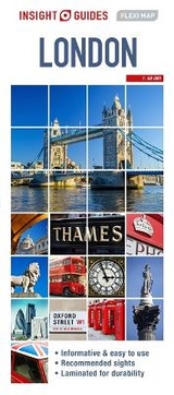
Insight Flexi Map: London
Seiten
2015
|
6th Revised edition
Insight Guides (Verlag)
978-1-78005-393-6 (ISBN)
Insight Guides (Verlag)
978-1-78005-393-6 (ISBN)
- Titel ist leider vergriffen;
keine Neuauflage - Artikel merken
Zu diesem Artikel existiert eine Nachauflage
Features detailed descriptions and photographs of a carefully selected number of recommended sights London has to offer. This book also includes information on getting around, tipping, opening times, public holidays, emergency telephone numbers and much more.
Flexi Map London is much more than just a laminated map. The Tourist Information section includes detailed descriptions and some stunning photographs of a carefully selected number of recommended sights, these sights are linked to the mapping by easy to find numbered markers. There is also an abundance of helpful information on getting around, tipping, opening times, public holidays, emergency telephone numbers and much more.
The comprehensive index has been divided into different categories to make locating places as easy as possible. The laminated, tear-resistant finish is tough, weatherproof and can be written on using a non-permanent marker.
The main map shows Central London at a scale of 1:16 500 (1cm = 0.165km) and highlights numerous places of interest such as public buildings, hotels and parks.
For those wishing to travel slightly further afield there is also a map of Greater London, the scale of this map is 1:220 000 (1cm = 2.2km).
Insight Guides wherever possible uses local experts who provide insider know-how and share their love and knowledge of the destination.
| Erscheint lt. Verlag | 1.6.2015 |
|---|---|
| Reihe/Serie | Insight Guides Flexi Maps |
| Verlagsort | London |
| Sprache | englisch |
| Themenwelt | Reisen ► Karten / Stadtpläne / Atlanten ► Europa |
| ISBN-10 | 1-78005-393-2 / 1780053932 |
| ISBN-13 | 978-1-78005-393-6 / 9781780053936 |
| Zustand | Neuware |
| Informationen gemäß Produktsicherheitsverordnung (GPSR) | |
| Haben Sie eine Frage zum Produkt? |
Mehr entdecken
aus dem Bereich


aus dem Bereich
Karte (gefalzt) (2024)
Freytag-Berndt und ARTARIA (Verlag)
CHF 18,95
Georgien, Armenien, Aserbaidschan
Karte (gefalzt) (2025)
Freytag-Berndt und ARTARIA (Verlag)
CHF 24,90
markierte Wanderwege, Hütten, Radrouten
Karte (gefalzt) (2023)
Kompass-Karten (Verlag)
CHF 26,90