


Philip's Europe Road Map
Seiten
2015
Philip's (Verlag)
978-1-84907-356-1 (ISBN)
Philip's (Verlag)
978-1-84907-356-1 (ISBN)
- Titel erscheint in neuer Auflage
- Artikel merken
Zu diesem Artikel existiert eine Nachauflage
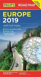
A fully-updated edition of Philip's double-sided folded sheet map covering the whole of Europe, from Portugal to Russia, at 55 miles to 1 inch (1 cm on the map = 35 km on the ground).
Philip's Europe Road Map shows the whole of Europe at a standard scale of 1:3.5M (1 cm on the map = 35 km on the ground). The map includes a comprehensive index, city-to-city distance table, and summer/winter weather maps.
The double-sided map has been specially prepared for long-distance travel, picking out major routes and destinations in bold colours for easy journey planning and route-finding, and is a convenient size for use in a vehicle.
The digital mapping gives excellent clarity, showing road networks in exceptional detail for this scale. A comprehensive index includes all towns and villages shown on the map.
| Erscheint lt. Verlag | 2.3.2015 |
|---|---|
| Verlagsort | London |
| Sprache | englisch |
| Maße | 124 x 248 mm |
| Gewicht | 80 g |
| Themenwelt | Reisen ► Karten / Stadtpläne / Atlanten ► Europa |
| ISBN-10 | 1-84907-356-2 / 1849073562 |
| ISBN-13 | 978-1-84907-356-1 / 9781849073561 |
| Zustand | Neuware |
| Informationen gemäß Produktsicherheitsverordnung (GPSR) | |
| Haben Sie eine Frage zum Produkt? |
Mehr entdecken
aus dem Bereich


aus dem Bereich
Buch | Leporello (2025)
Kompass-Karten (Verlag)
CHF 21,90