


Southwestern France - Michelin National Map 708
Map
Seiten
2015
|
updated 2018
Michelin Editions des Voyages (Verlag)
978-2-06-720071-5 (ISBN)
Michelin Editions des Voyages (Verlag)
978-2-06-720071-5 (ISBN)
- Titel erscheint in neuer Auflage
- Artikel merken
Zu diesem Artikel existiert eine Nachauflage
Michelin National Map Series help you easily plan your safe and enjoyable journey thanks to a comprehensive key, a complete name index as well a clever time & distance chart. Michelin's driving information will help you navigate safely in all circumstances, with scales from 1:150,000 to 1:28,500,000
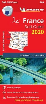
(Edition updated in 2018) MICHELIN National Map Southwestern France 708 will give you an detailed picture of your journey from Bayonne to Montpellerand La Rochelle to Clermont-Ferrand thanks to its clear and accurate mapping scale 1/500,000.
Our map will help you easily plan your safe and enjoyable journey in the southwestern parts of France thanks to a comprehensive key, a complete name index as well a clever time & distance chart. Michelin's driving information will help you navigate safely in all circumstances. Furthermore this map features zoom on major cities and towns as well as QR codes to the complete your journey with ViaMichelin. This map includes tourist sights, scenic route and is cross-referenced with the famous MICHELIN Green Guide highlighting destinations worth stopping for! With MICHELIN National Maps, find more than just your way!
| Erscheint lt. Verlag | 9.1.2015 |
|---|---|
| Reihe/Serie | Michelin National Maps |
| Verlagsort | Paris |
| Sprache | englisch |
| Maße | 113 x 250 mm |
| Gewicht | 118 g |
| Themenwelt | Reisen ► Karten / Stadtpläne / Atlanten ► Europa |
| ISBN-10 | 2-06-720071-2 / 2067200712 |
| ISBN-13 | 978-2-06-720071-5 / 9782067200715 |
| Zustand | Neuware |
| Informationen gemäß Produktsicherheitsverordnung (GPSR) | |
| Haben Sie eine Frage zum Produkt? |
Mehr entdecken
aus dem Bereich


aus dem Bereich
Karte (gefalzt) (2024)
Freytag-Berndt und ARTARIA (Verlag)
CHF 18,95
Georgien, Armenien, Aserbaidschan
Karte (gefalzt) (2025)
Freytag-Berndt und ARTARIA (Verlag)
CHF 24,90