


Philip's Complete Road Atlas Britain and Ireland 2015
Seiten
2014
Philip's (Verlag)
978-1-84907-318-9 (ISBN)
Philip's (Verlag)
978-1-84907-318-9 (ISBN)
- Titel erscheint in neuer Auflage
- Artikel merken
Zu diesem Artikel existiert eine Nachauflage
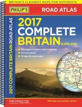
This mid-format atlas features fully updated maps from the Philip's digital database, which has been voted Britain's clearest and most detailed in an independent consumer survey, and includes speed-camera locations and the associated speed limits.
Philip's Complete Road Atlas Britain and Ireland 2015 contains 160 pages of road maps covering Britain at 3 miles to 1 inch, with the Western Isles, Orkney and Shetland at smaller scales. The maps clearly mark service areas, roundabouts and multi-level junctions, and in rural areas distinguish between roads over and under 4 metres wide - a boon for drivers of wide vehicles.
The atlas also includes 10 pages of route-planning maps, a distance table, 10 large-scale city approach maps with named arterial roads, and 64 extra-detailed and fully indexed town and city plans.
Philip's has been at the forefront of creating maps and atlases since 1834. Whether a local street map or a fact-packed World Atlas, we use the most up-to-date technology, expertise and our global network to ensure our customers have all the information they need.
| Erscheint lt. Verlag | 7.7.2014 |
|---|---|
| Reihe/Serie | Philips Road Atlas |
| Verlagsort | London |
| Sprache | englisch |
| Maße | 228 x 296 mm |
| Gewicht | 778 g |
| Themenwelt | Reisen ► Karten / Stadtpläne / Atlanten ► Europa |
| ISBN-10 | 1-84907-318-X / 184907318X |
| ISBN-13 | 978-1-84907-318-9 / 9781849073189 |
| Zustand | Neuware |
| Informationen gemäß Produktsicherheitsverordnung (GPSR) | |
| Haben Sie eine Frage zum Produkt? |
Mehr entdecken
aus dem Bereich


aus dem Bereich
Buch | Leporello (2025)
Kompass-Karten (Verlag)
CHF 21,90