


Dublin Streetfinder Colour Atlas and Guide
Seiten
2001
|
New edition
Collins (Verlag)
978-0-00-449085-4 (ISBN)
Collins (Verlag)
978-0-00-449085-4 (ISBN)
- Titel erscheint in neuer Auflage
- Artikel merken
Zu diesem Artikel existiert eine Nachauflage
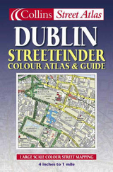
4 inches to 1 mile 1:15,840 approx. Handy full colour street atlas featuring brand new digital mapping with guide to places of interest in Dublin.
MAIN FEATURES
• Brand new, full colour mapping with colour classified roads
• Route planning maps showing places of tourist interest
• Full index to streets
• Guide information for Dublin City
INCLUDES
• Important buildings and places of interest
• Car parks and railway stations
AREA OF COVERAGE
From Beaumont in the north to Dundrum in the south, includes Castleknock and Phoenix Park in the west to the coast in the east.
WHO THE PRODUCT IS AIMED AT
The handy format and wealth of information in the product make it an essential purchase for visitors. The large area of coverage and clarity of the mapping will mean that residents and business users will also find it an invaluable product.
| Erscheint lt. Verlag | 2.4.2001 |
|---|---|
| Verlagsort | London |
| Sprache | englisch |
| Maße | 129 x 198 mm |
| Gewicht | 114 g |
| Themenwelt | Reisen ► Karten / Stadtpläne / Atlanten ► Europa |
| ISBN-10 | 0-00-449085-1 / 0004490851 |
| ISBN-13 | 978-0-00-449085-4 / 9780004490854 |
| Zustand | Neuware |
| Informationen gemäß Produktsicherheitsverordnung (GPSR) | |
| Haben Sie eine Frage zum Produkt? |
Mehr entdecken
aus dem Bereich


aus dem Bereich
Buch | Leporello (2025)
Kompass-Karten (Verlag)
CHF 21,90