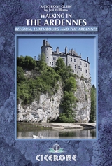
Walking in the Ardennes
Cicerone Press (Verlag)
978-1-85284-686-2 (ISBN)
A guidebook to 32 day walks and one multi-day trek across the Ardennes region. Exploring the beautiful scenery of southeastern Belgium and venturing across the border into Luxembourg and France, the walks are suitable for beginner and experienced walkers alike.
Day walks range from 2 to 24km (1–15 miles) and can be enjoyed in 1–8 hours. The Sentier du Nord trek (part of the GR57 long-distance trail) from Weiswampach to Diekirch is described in 6 stages covering 68km (42 miles).
1:50,000 maps are included for each walk
Detailed information on planning, refreshments and public transport
Highlights include Bouillon and its castle
After a short commission in the Army, Jeff Williams trained in paediatric medicine and worked as a consultant paediatrician in North Wales for 30 years. During that time he wrote walking and climbing guides for the Stubai, Silvretta and Ötztal Alps, as well as the Cicerone guide Walking in the Drakensberg. Jeff also trained as a safari guide in South Africa and currently teaches new guides and lectures in Wales on guiding and walking.
Map key
Overview maps
Introduction
Geography
Geology
World War II and the Ardennes
Plants and wildlife
Food and drink
Early guides to the Ardennes
Scope of this guide
Getting there
When to visit
Accommodation
Money
Health and safety
What to take
Maps
Waymarking
Communications
The RAVeL network
Using this guide
1 Bouillon and the River Semois
Walk 1 Bouillon to Sedan
Walk 2 Corbion, Cr&##xea;tes de Frahan, Rochehaut and Corbion
Walk 3 Bouillon to Poupehan and back
Walk 4 Vresse and Membre
Walk 5 Bohan and the French frontier
Walk 6 Dohan and the Semois
Walk 7 L'Abbaye Notre-Dame d'Orval
Walk 8 Herbeumont: Viaduct and ch&##xe2;teau
Walk 9 Herbeumont: Mortehan, viaduct and the ch&##xe2;teau
Walk 10 La Ramonette
Walk 11 The Belv&##xe9;d&##xe8;re
Walk 12 Arboretum and patriots' memorial
2 Spa
Walk 13 Solwaster and the Statte stream
Walk 14 Fagne de Malchamps
Walk 15 Ch&##xe2;teau de Franchimont
Walk 16 L'Étang de Chawion and Lac de Warfaaz
3 Hautes Fagnes, Malm&##xe9;dy and Stavelot
Walk 17 An excursion in the Hautes Fagnes
Walk 18 Kaiser Karl's Bettstatt
Walk 19 Cascade and canyon
Walk 20 Ch&##xe2;teau de Reinhardstein
Walk 21 Stavelot, Coo and Trois Ponts triangle
4 Dinant, the Meuse and the Lesse
Walk 22 The Meuse and the Lesse
Walk 23 Gendron-Celles station to Houyet along the Lesse
Walk 24 Le Parc de Furfooz
Walk 25 Ch&##xe2;teau de Walzin
Walk 26 Belvaux and the Bois de Niau
Walk 27 Han-sur-Lesse and Rochefort
Walk 28 Ch&##xe2;teau de Montaigle
5 La Roche-en-Ardenne
Walk 29 Maboge, Borz&##xe9;e and the ridges above the Ourthe
Walk 30 The Celtic fort
Walk 31 Circuit of the Lac des Deux Ourthes
Walk 32 La Roche, Cielle and Le Grand Bois
6 Luxembourg
Walk 33 The Sentier du Nord
Stage 1 Weiswampach to Troisvierges
Stage 2 Troisvierges to Clervaux
Stage 3 Clervaux to Drauffelt
Stage 4 Drauffelt to Kautenbach
Stage 5 Kautenbach to Goebelsmühle
Stage 6 Goebelsmühle to Diekirch
Appendix A Route summary table
Appendix B Useful websites
| Erscheint lt. Verlag | 15.6.2014 |
|---|---|
| Reihe/Serie | Cicerone guidebooks |
| Zusatzinfo | 100 photos and 45 maps |
| Verlagsort | Kendal |
| Sprache | englisch |
| Maße | 116 x 172 mm |
| Gewicht | 250 g |
| Themenwelt | Sachbuch/Ratgeber ► Sport |
| Reiseführer ► Europa ► Belgien | |
| Reiseführer ► Europa ► Luxemburg | |
| Reisen ► Sport- / Aktivreisen ► Europa | |
| ISBN-10 | 1-85284-686-0 / 1852846860 |
| ISBN-13 | 978-1-85284-686-2 / 9781852846862 |
| Zustand | Neuware |
| Informationen gemäß Produktsicherheitsverordnung (GPSR) | |
| Haben Sie eine Frage zum Produkt? |
aus dem Bereich