


Big Road Atlas Britain
Seiten
2001
|
Revised edition
Automobile Association (Verlag)
978-0-7495-2967-3 (ISBN)
Automobile Association (Verlag)
978-0-7495-2967-3 (ISBN)
- Titel erscheint in neuer Auflage
- Artikel merken
Zu diesem Artikel existiert eine Nachauflage
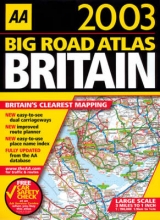
This new edition, with a scale of 3 miles to 1 inch, includes a town plan section with 60 town plans, plus a Central London street map. It also contains large-scale district maps of Birmingham, Glasgow, Manchester, Tyne and Wear and London.
| Erscheint lt. Verlag | 31.7.2001 |
|---|---|
| Zusatzinfo | all colour maps |
| Verlagsort | Basingstoke |
| Sprache | englisch |
| Maße | 285 x 389 mm |
| Gewicht | 690 g |
| Themenwelt | Reisen ► Karten / Stadtpläne / Atlanten ► Europa |
| ISBN-10 | 0-7495-2967-9 / 0749529679 |
| ISBN-13 | 978-0-7495-2967-3 / 9780749529673 |
| Zustand | Neuware |
| Informationen gemäß Produktsicherheitsverordnung (GPSR) | |
| Haben Sie eine Frage zum Produkt? |
Mehr entdecken
aus dem Bereich


aus dem Bereich
Buch | Leporello (2025)
Kompass-Karten (Verlag)
CHF 21,90