


London Master Street Atlas
Seiten
2001
|
Revised edition
Collins (Verlag)
978-0-00-449065-6 (ISBN)
Collins (Verlag)
978-0-00-449065-6 (ISBN)
- Titel erscheint in neuer Auflage
- Artikel merken
Zu diesem Artikel existiert eine Nachauflage
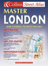
1:20,000 3.2 inches to 1 mile, 1:10,000 6.3 inches to 1 mile Attractive atlas using the Bartholomew digital database mapping. A huge amount of detail is included with a high level of clarity
MAIN FEATURES
• Main mapping at 3.2 inches to1 mile
• Enlarged central area at 6.3 inches to 1 mile
• Route planning map of the London area at 2 miles to 1 inch
• Places, streets and places of interest all fully indexed
INCLUDES
• Colour classified roads and buildings
• Postal district boundaries
• Car parks, hospitals and police stations
• Places of interest
AREA OF COVERAGE
Extends from Brookmans Park in the north to Leatherhead in the south and from Staines in the west to Rainham in the east.
WHO THE PRODUCT IS AIMED AT
Especially designed for the local resident and business professional alike in an economical paperback binding. It has a wealth of detail but retains its clarity. It has a fine grid system making it extremely easy to use.
OTHER PRODUCTS IN THE SERIES
Collins also sell this title in a hardback cover.
| Erscheint lt. Verlag | 5.3.2001 |
|---|---|
| Zusatzinfo | Index |
| Verlagsort | London |
| Sprache | englisch |
| Maße | 210 x 297 mm |
| Gewicht | 855 g |
| Themenwelt | Reisen ► Karten / Stadtpläne / Atlanten ► Europa |
| ISBN-10 | 0-00-449065-7 / 0004490657 |
| ISBN-13 | 978-0-00-449065-6 / 9780004490656 |
| Zustand | Neuware |
| Informationen gemäß Produktsicherheitsverordnung (GPSR) | |
| Haben Sie eine Frage zum Produkt? |
Mehr entdecken
aus dem Bereich


aus dem Bereich
Buch | Leporello (2025)
Kompass-Karten (Verlag)
CHF 21,90