


Philip's Multiscale Britain
Seiten
2000
Philip's (Verlag)
978-0-540-07898-1 (ISBN)
Philip's (Verlag)
978-0-540-07898-1 (ISBN)
- Titel erscheint in neuer Auflage
- Artikel merken
Zu diesem Artikel existiert eine Nachauflage
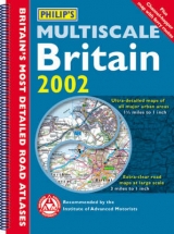
This road atlas features 110 pages of road mapping at 3 miles to 1 inch. It contains 33 pages of ultra-large-scale road mapping for all major British cities at 1.5 miles to 1 inch including a cross-Channel map showing ferry routes with Northern France and Belgium.
| Erscheint lt. Verlag | 10.7.2000 |
|---|---|
| Zusatzinfo | colour maps, index |
| Verlagsort | London |
| Sprache | englisch |
| Maße | 285 x 394 mm |
| Gewicht | 760 g |
| Themenwelt | Reisen ► Karten / Stadtpläne / Atlanten ► Europa |
| ISBN-10 | 0-540-07898-0 / 0540078980 |
| ISBN-13 | 978-0-540-07898-1 / 9780540078981 |
| Zustand | Neuware |
| Informationen gemäß Produktsicherheitsverordnung (GPSR) | |
| Haben Sie eine Frage zum Produkt? |
Mehr entdecken
aus dem Bereich


aus dem Bereich
Buch | Leporello (2025)
Kompass-Karten (Verlag)
CHF 21,90