


France Route Planning
2013
Michelin Editions des Voyages (Verlag)
978-2-06-718042-0 (ISBN)
Michelin Editions des Voyages (Verlag)
978-2-06-718042-0 (ISBN)
- Titel erscheint in neuer Auflage
- Artikel merken
Zu diesem Artikel existiert eine Nachauflage
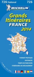
Updated annually, MICHELIN National Map France Route Planning 2013 will give you an overall picture of your journey thanks to its clear and accurate mapping scale 1/1 000 000. Our map will help you easily plan your safe and enjoyable journey in France thanks to a comprehensive key, a complete name index as well a clever distance & time chart. Michelin's driving information will help you navigate safely in all circumstances. With MICHELIN National Maps, find more than just your way!
| Erscheint lt. Verlag | 11.1.2013 |
|---|---|
| Reihe/Serie | Michelin National Maps ; 726 |
| Zusatzinfo | colour mapping |
| Verlagsort | Paris |
| Sprache | englisch |
| Maße | 113 x 250 mm |
| Themenwelt | Reisen ► Karten / Stadtpläne / Atlanten ► Europa |
| ISBN-10 | 2-06-718042-8 / 2067180428 |
| ISBN-13 | 978-2-06-718042-0 / 9782067180420 |
| Zustand | Neuware |
| Informationen gemäß Produktsicherheitsverordnung (GPSR) | |
| Haben Sie eine Frage zum Produkt? |
Mehr entdecken
aus dem Bereich


aus dem Bereich
Narvik
Karte (gefalzt) (2023)
Freytag-Berndt und ARTARIA (Verlag)
CHF 21,90
Karte (gefalzt) (2024)
Freytag-Berndt und ARTARIA (Verlag)
CHF 18,95
Karte (gefalzt) (2025)
Kompass-Karten (Verlag)
CHF 31,90