


AA Easy Read France
Seiten
2012
|
8th edition
Automobile Association (Verlag)
978-0-7495-7380-5 (ISBN)
Automobile Association (Verlag)
978-0-7495-7380-5 (ISBN)
- Titel erscheint in neuer Auflage
- Artikel merken
Zu diesem Artikel existiert eine Nachauflage
Fully revised and updated for 2013, this specialist A4 road atlas of France provides super-scale mapping at 2.8 miles to 1 inch making it very easy to read. There is a 12-page route planner, 86 city-centre plans, large-scale city environs maps, over 18,500 tourist sites shown on the mapping and French names used to match local road signs.
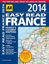
Fully revised and updated for 2013, this specialist A4 road atlas of France provides super-scale mapping at 2.8 miles to 1 inch making it very easy to read. There is a 12-page route planner, 86 city-centre plans, large-scale city environs maps of Paris, Lyon, Marseille and Lille, over 18,500 tourist sites shown on the mapping and French names used to match local road signs. Road mapping for Corsica is included, and also a central Paris city plan and district maps of Paris, Lyon, Marseille, Lille.
Fully revised and updated for 2013, this specialist A4 road atlas of France provides super-scale mapping at 2.8 miles to 1 inch making it very easy to read. There is a 12-page route planner, 86 city-centre plans, large-scale city environs maps of Paris, Lyon, Marseille and Lille, over 18,500 tourist sites shown on the mapping and French names used to match local road signs. Road mapping for Corsica is included, and also a central Paris city plan and district maps of Paris, Lyon, Marseille, Lille.
AA Publishing is the UK's largest travel publisher, with an extensive range of inspiring travel guides, dependable driving books, and trusted maps and atlases.
| Erscheint lt. Verlag | 16.11.2012 |
|---|---|
| Zusatzinfo | Scale: 2.8 miles to 1 inch |
| Verlagsort | Basingstoke |
| Sprache | englisch |
| Maße | 228 x 297 mm |
| Themenwelt | Reisen ► Karten / Stadtpläne / Atlanten ► Europa |
| ISBN-10 | 0-7495-7380-5 / 0749573805 |
| ISBN-13 | 978-0-7495-7380-5 / 9780749573805 |
| Zustand | Neuware |
| Informationen gemäß Produktsicherheitsverordnung (GPSR) | |
| Haben Sie eine Frage zum Produkt? |
Mehr entdecken
aus dem Bereich


aus dem Bereich
Buch | Leporello (2025)
Kompass-Karten (Verlag)
CHF 21,90