


Philip's London and M25 Navigator Road Map
Seiten
2011
Philip's (Verlag)
978-1-84907-172-7 (ISBN)
Philip's (Verlag)
978-1-84907-172-7 (ISBN)
- Titel erscheint in neuer Auflage
- Artikel merken
Zu diesem Artikel existiert eine Nachauflage
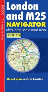
Exceptionally detailed Navigator mapping at 1.5 miles to 1 inch. Every junction, roundabout and slip-road shown in detail. Includes indexed street plan of central London. Single-sided map for ease of use and to allow wall hanging.
This new edition of Philip's London and M25 Navigator Road Map features ultra-large-scale and detailed up-to-date Navigator mapping, ranging from Chatham in the east to Maidenhead in the west, and from Hemel Hempstead in the north to Gatwick Airport in the south.The map contains highly detailed coverage at 1.5 miles to 1 inch of the region's road network, from motorways to minor country lanes and rural tracks - and even major footpaths - and every junction, roundabout and slip-road is shown in detail.There is much other detail, including thousands of individually named farms, houses and hamlets. Also shown are airports, airfields, stations, ferries, canals, marinas and an abundance of places of interest.Opening out to 680 x 1200mm, Philip's London and M25 Navigator Road Map has a comprehensive index and includes an indexed street plan of central London.Philip's Navigator Road Maps are designed for both professional and leisure users. For professionals, the wealth of detail makes activities such as regional planning and delivery driving far easier. Also, the maps are fully printed on one side (including the index) to allow hanging as a wall map. For leisure, the wealth of detail greatly eases the navigation of both main roads and byways, and increases the pleasure of touring by opening up new possibilities.
This new edition of Philip's London and M25 Navigator Road Map features ultra-large-scale and detailed up-to-date Navigator mapping, ranging from Chatham in the east to Maidenhead in the west, and from Hemel Hempstead in the north to Gatwick Airport in the south.The map contains highly detailed coverage at 1.5 miles to 1 inch of the region's road network, from motorways to minor country lanes and rural tracks - and even major footpaths - and every junction, roundabout and slip-road is shown in detail.There is much other detail, including thousands of individually named farms, houses and hamlets. Also shown are airports, airfields, stations, ferries, canals, marinas and an abundance of places of interest.Opening out to 680 x 1200mm, Philip's London and M25 Navigator Road Map has a comprehensive index and includes an indexed street plan of central London.Philip's Navigator Road Maps are designed for both professional and leisure users. For professionals, the wealth of detail makes activities such as regional planning and delivery driving far easier. Also, the maps are fully printed on one side (including the index) to allow hanging as a wall map. For leisure, the wealth of detail greatly eases the navigation of both main roads and byways, and increases the pleasure of touring by opening up new possibilities.
| Erscheint lt. Verlag | 4.4.2011 |
|---|---|
| Verlagsort | London |
| Sprache | englisch |
| Maße | 129 x 240 mm |
| Gewicht | 108 g |
| Themenwelt | Reisen ► Karten / Stadtpläne / Atlanten ► Europa |
| ISBN-10 | 1-84907-172-1 / 1849071721 |
| ISBN-13 | 978-1-84907-172-7 / 9781849071727 |
| Zustand | Neuware |
| Informationen gemäß Produktsicherheitsverordnung (GPSR) | |
| Haben Sie eine Frage zum Produkt? |
Mehr entdecken
aus dem Bereich


aus dem Bereich
Buch | Leporello (2025)
Kompass-Karten (Verlag)
CHF 21,90