


Philip's Britain and Ireland Road Map
Seiten
2011
Philip's (Verlag)
978-1-84907-167-3 (ISBN)
Philip's (Verlag)
978-1-84907-167-3 (ISBN)
- Titel erscheint in neuer Auflage
- Artikel merken
Zu diesem Artikel existiert eine Nachauflage
A fully-updated edition of Philip's double-sided folded sheet map, showing the whole of Britain and Ireland for easy in-car use.
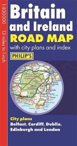
This new edition of Philip's Britain and Ireland Road Map has been fully revised and updated. The map has been specially prepared for tourism and long-distance travel, allowing for easy trip planning and route-finding. It is also ideally suited for office use, such as for sales territory planning. The double-sided map features Philip's superb digital cartography, giving excellent clarity at 13 miles to 1 inch and showing road networks in exceptional detail for this scale. The mapping shows all major roads, and includes airports and ferries, national parks, forest parks and areas of outstanding natural beauty. A comprehensive index includes all towns and villages shown on the map. City plans for Belfast, Cardiff, Dublin, Edinburgh and London are also featured.
This new edition of Philip's Britain and Ireland Road Map has been fully revised and updated. The map has been specially prepared for tourism and long-distance travel, allowing for easy trip planning and route-finding. It is also ideally suited for office use, such as for sales territory planning. The double-sided map features Philip's superb digital cartography, giving excellent clarity at 13 miles to 1 inch and showing road networks in exceptional detail for this scale. The mapping shows all major roads, and includes airports and ferries, national parks, forest parks and areas of outstanding natural beauty. A comprehensive index includes all towns and villages shown on the map. City plans for Belfast, Cardiff, Dublin, Edinburgh and London are also featured.
| Erscheint lt. Verlag | 7.3.2011 |
|---|---|
| Verlagsort | London |
| Sprache | englisch |
| Maße | 120 x 247 mm |
| Gewicht | 90 g |
| Themenwelt | Reisen ► Karten / Stadtpläne / Atlanten ► Europa |
| ISBN-10 | 1-84907-167-5 / 1849071675 |
| ISBN-13 | 978-1-84907-167-3 / 9781849071673 |
| Zustand | Neuware |
| Informationen gemäß Produktsicherheitsverordnung (GPSR) | |
| Haben Sie eine Frage zum Produkt? |
Mehr entdecken
aus dem Bereich


aus dem Bereich
Buch | Leporello (2025)
Kompass-Karten (Verlag)
CHF 21,90