


Philip's Road Atlas Britain and Ireland 2012
Seiten
2011
Philip's (Verlag)
978-1-84907-157-4 (ISBN)
Philip's (Verlag)
978-1-84907-157-4 (ISBN)
- Titel erscheint in neuer Auflage
- Artikel merken
Zu diesem Artikel existiert eine Nachauflage
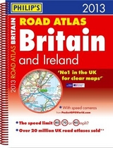
Fixed speed cameras shown on maps with speed limits. 160 pages of fully updated road maps at 3 miles to 1 inch. 32 town and city plans. 8 pages of city approach maps with named arterial roads. Exciting PR campaign to be announced.
Philip's Road Atlas Britain and Ireland 2012 contains 160 pages of road maps covering Britain at 3 miles to 1 inch, with the Western Isles, Orkney and Shetland at smaller scales. The maps clearly mark service areas, roundabouts and multi-level junctions, and in rural areas distinguish between roads over and under 4 metres wide - a boon for drivers of wide vehicles.The atlas also includes 10 pages of route-planning maps, a distance table, 4 large-scale city approach maps with named arterial roads, and 32 extra-detailed town and city plans.
Philip's Road Atlas Britain and Ireland 2012 contains 160 pages of road maps covering Britain at 3 miles to 1 inch, with the Western Isles, Orkney and Shetland at smaller scales. The maps clearly mark service areas, roundabouts and multi-level junctions, and in rural areas distinguish between roads over and under 4 metres wide - a boon for drivers of wide vehicles.The atlas also includes 10 pages of route-planning maps, a distance table, 4 large-scale city approach maps with named arterial roads, and 32 extra-detailed town and city plans.
| Erscheint lt. Verlag | 4.7.2011 |
|---|---|
| Verlagsort | London |
| Sprache | englisch |
| Maße | 227 x 296 mm |
| Gewicht | 632 g |
| Themenwelt | Reisen ► Karten / Stadtpläne / Atlanten ► Europa |
| ISBN-10 | 1-84907-157-8 / 1849071578 |
| ISBN-13 | 978-1-84907-157-4 / 9781849071574 |
| Zustand | Neuware |
| Informationen gemäß Produktsicherheitsverordnung (GPSR) | |
| Haben Sie eine Frage zum Produkt? |
Mehr entdecken
aus dem Bereich


aus dem Bereich
Buch | Leporello (2025)
Kompass-Karten (Verlag)
CHF 21,90