


AA Road Atlas Ireland
Seiten
2010
|
4th edition
Automobile Association (Verlag)
978-0-7495-6539-8 (ISBN)
Automobile Association (Verlag)
978-0-7495-6539-8 (ISBN)
- Titel erscheint in neuer Auflage
- Artikel merken
Zu diesem Artikel existiert eine Nachauflage
An atlas that includes AA approved camping sites and AA recommended golf courses, car parks, picnic sites, port plans and ferry routes.
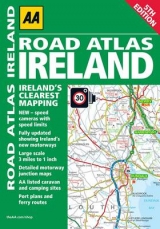
Updated from Ireland's Official Mapping Agencies, OSI and OSNI, this atlas includes AA approved camping sites and AA recommended golf courses, car parks, picnic sites, port plans and ferry routes. Plus, motorway strip maps detailing all of Ireland's motorway junctions. There are 11 detailed city and town plans: Belfast, Cork, Londonderry, Dublin, Galway, Killarney, Kilkenny, Limerick, Sligo and Waterford and an easy-to-read 3,500 place name index, including tourist sites.
Updated from Ireland's Official Mapping Agencies, OSI and OSNI, this atlas includes AA approved camping sites and AA recommended golf courses, car parks, picnic sites, port plans and ferry routes. Plus, motorway strip maps detailing all of Ireland's motorway junctions. There are 11 detailed city and town plans: Belfast, Cork, Londonderry, Dublin, Galway, Killarney, Kilkenny, Limerick, Sligo and Waterford and an easy-to-read 3,500 place name index, including tourist sites.
| Erscheint lt. Verlag | 1.4.2010 |
|---|---|
| Zusatzinfo | 3 miles to 1 inch (1:200,000) |
| Verlagsort | Basingstoke |
| Sprache | englisch |
| Maße | 210 x 297 mm |
| Themenwelt | Reisen ► Karten / Stadtpläne / Atlanten ► Europa |
| ISBN-10 | 0-7495-6539-X / 074956539X |
| ISBN-13 | 978-0-7495-6539-8 / 9780749565398 |
| Zustand | Neuware |
| Informationen gemäß Produktsicherheitsverordnung (GPSR) | |
| Haben Sie eine Frage zum Produkt? |
Mehr entdecken
aus dem Bereich


aus dem Bereich
Buch | Leporello (2025)
Kompass-Karten (Verlag)
CHF 21,90