


Philip's Mini Atlas London
Seiten
2010
Philip's (Verlag)
978-1-84907-062-1 (ISBN)
Philip's (Verlag)
978-1-84907-062-1 (ISBN)
- Titel erscheint in neuer Auflage
- Artikel merken
Zu diesem Artikel existiert eine Nachauflage
A mini street atlas of inner London. It features street maps of central London that are at 7 inches to 1 mile, with the rest of inner London at the clear scale of 3.5 inches to 1 mile. It includes a theatres and cinemas map of central London that locates more than 50 theatres and cinemas.
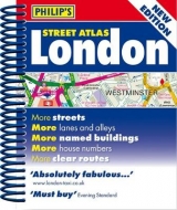
This is a fully revised edition of this mini street atlas of inner London, which gives comprehensive and detailed coverage. The street maps of central London are at 7 inches to 1 mile, with the rest of inner London at the clear scale of 3.5 inches to 1 mile. The maps mark every named street, lane, alley, court and walkway, plus car parks, tube, rail and bus stations, post offices, schools, colleges, hospitals, police and fire stations, places of worship, leisure centres, footpaths and bridleways, golf courses, and many other places of interest. A theatres and cinemas map of central London locates more than 50 theatres and cinemas, and there is also a map of the entire London Underground. The comprehensive index lists street names and postcodes, plus hundreds of places of interest. Schools, hospitals, railway stations and shopping centres, etc, are highlighted in red, while leisure and entertainment venues such as museums, galleries and sports grounds are shown in blue. This atlas is suitable for both drivers and pedestrians. For drivers, route-finding in London is much easier as through-routes are highlighted, giving the user the equivalent of local knowledge of an area.
Speed cameras, one-way streets and restricted turns are clearly displayed with the Congestion Charge Zone. For pedestrians, tourist sights and attractions are clearly labelled, public transport systems are featured, and its compact size fits easily into a briefcase or handbag. The clear layout and mini size is ideal for cyclists too.
| Erscheint lt. Verlag | 15.3.2010 |
|---|---|
| Reihe/Serie | Street Atlases |
| Verlagsort | London |
| Sprache | englisch |
| Maße | 115 x 138 mm |
| Gewicht | 198 g |
| Themenwelt | Reisen ► Karten / Stadtpläne / Atlanten ► Europa |
| ISBN-10 | 1-84907-062-8 / 1849070628 |
| ISBN-13 | 978-1-84907-062-1 / 9781849070621 |
| Zustand | Neuware |
| Informationen gemäß Produktsicherheitsverordnung (GPSR) | |
| Haben Sie eine Frage zum Produkt? |
Mehr entdecken
aus dem Bereich


aus dem Bereich
Buch | Leporello (2025)
Kompass-Karten (Verlag)
CHF 21,90