


2000 Collins Road Atlas Italy
Seiten
1999
|
Revised edition
Collins (Verlag)
978-0-00-448958-2 (ISBN)
Collins (Verlag)
978-0-00-448958-2 (ISBN)
- Titel erscheint in neuer Auflage
- Artikel merken
Zu diesem Artikel existiert eine Nachauflage
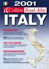
Scale 1 : 300 000 (1 cm to 3km / 1 inch to 4.7 miles) Fully revised and updated road atlas of all of Italy and including city centre plans and comprehensive place-name index.
AREA OF COVERAGE
All of Italy from the borders with France, Switzerland and Austria in the north to Sicily in the south and including Sardinia.
MAIN FEATURES
Detailed large-scale road mapping of Italy at 1:300 000. 16 informative city and town centre plans of Bari, Bologna, Cágliari, Florence, Genoa, Naples, Milan, Padua, Palermo, Pescara, Perúgia, Rome, Turin, Trieste, Verona and Venice. Fully classified road network, tourist information, ferries and railways. Route planning map and comprehensive place name index
.
WHO THE PRODUCT IS AIMED AT
Motorists planning a visit to Italy and for using on the journey.
OTHER PRODUCTS IN THE SERIES
Collins Road Atlas France
Collins Road Atlas Europe
Collins Road Atlas Britain
Collins Road Atlas USA Canada and Mexico
Collins Road Atlas Spain & Portugal
| Erscheint lt. Verlag | 6.12.1999 |
|---|---|
| Verlagsort | London |
| Sprache | englisch |
| Maße | 204 x 292 mm |
| Gewicht | 358 g |
| Themenwelt | Reisen ► Karten / Stadtpläne / Atlanten ► Europa |
| ISBN-10 | 0-00-448958-6 / 0004489586 |
| ISBN-13 | 978-0-00-448958-2 / 9780004489582 |
| Zustand | Neuware |
| Informationen gemäß Produktsicherheitsverordnung (GPSR) | |
| Haben Sie eine Frage zum Produkt? |
Mehr entdecken
aus dem Bereich


aus dem Bereich
Buch | Leporello (2025)
Kompass-Karten (Verlag)
CHF 21,90