


London Street Atlas
Seiten
2000
|
Revised edition
Collins (Verlag)
978-0-00-448989-6 (ISBN)
Collins (Verlag)
978-0-00-448989-6 (ISBN)
- Titel erscheint in neuer Auflage
- Artikel merken
Zu diesem Artikel existiert eine Nachauflage
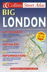
Central area – 7.68 inches to 1 mile (1:8,250) Outer area – 3.84 inches to 1 mile (1:16,500) Large scale, full colour, street level mapping from the Bartholomew digital database, with handy ‘lie flat’ spiral binding.
MAIN FEATURES
• Central London at extra large scale of 7.68 inches to 1 mile
• Extensive area of coverage
• Extremely clear, attractive mapping
INCLUDES
• Full indexes to streets, place names and places of interest
• Theatres & Cinemas plus shopping maps
• Classified roads and colour coded land use
AREA OF COVERAGE
Coverage stretches from Enfield in the north to Croydon in the south and from Hillingdon in the west to Dagenham in the east.
WHO THE PRODUCT IS AIMED AT
The wealth of detail and handy spiral binding make this an essential purchase for businesses and residents.
| Erscheint lt. Verlag | 6.3.2000 |
|---|---|
| Verlagsort | London |
| Sprache | englisch |
| Maße | 156 x 240 mm |
| Gewicht | 781 g |
| Themenwelt | Reisen ► Karten / Stadtpläne / Atlanten ► Europa |
| ISBN-10 | 0-00-448989-6 / 0004489896 |
| ISBN-13 | 978-0-00-448989-6 / 9780004489896 |
| Zustand | Neuware |
| Informationen gemäß Produktsicherheitsverordnung (GPSR) | |
| Haben Sie eine Frage zum Produkt? |
Mehr entdecken
aus dem Bereich


aus dem Bereich
Buch | Leporello (2025)
Kompass-Karten (Verlag)
CHF 21,90