


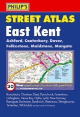
Philip's Street Atlas East Kent
Pocket
Seiten
2008
Philip's (Verlag)
978-0-540-09487-5 (ISBN)
Philip's (Verlag)
978-0-540-09487-5 (ISBN)
- Titel erscheint in neuer Auflage
- Artikel merken
Zu diesem Artikel existiert eine Nachauflage
* Complete coverage of all urban and rural areas with postcode boundaries. * Comprehensive street index complete with postcodes, schools, industrial estates, hospitals, sports centres, etc. * Available in two formats. * Part of a series of street atlases which covers all of England, Wales, Northern Ireland and much of Scotland.
The 3rd impression of this successful colour atlas of East Kent, giving the only comprehensive, detailed coverage of the region. A street atlas of West Kent is also available in the same format.The mapping is prepared by the Ordnance Survey and gives the user complete coverage of all urban and rural areas. 'The mapping is at a standard scale of 2 2/3 inches to 1 mile and is complete with postcode boundaries.The atlas is ideally suited for both business and leisure use. There is a route-planning map at the front of the atlas. The main maps show every named road, street and lane clearly with through-routes highlighted. School locations are marked and emergency services, hospitals, police stations, car parks and rail and bus station locations are all featured. There is a comprehensive index of street names and postcodes including schools, industrial estates, hospitals, sports centres, etc. These are highlighted in red in the spiral and hardback atlases.Main map scale: 2 2/3 inches to 1 mile
The 3rd impression of this successful colour atlas of East Kent, giving the only comprehensive, detailed coverage of the region. A street atlas of West Kent is also available in the same format.The mapping is prepared by the Ordnance Survey and gives the user complete coverage of all urban and rural areas. 'The mapping is at a standard scale of 2 2/3 inches to 1 mile and is complete with postcode boundaries.The atlas is ideally suited for both business and leisure use. There is a route-planning map at the front of the atlas. The main maps show every named road, street and lane clearly with through-routes highlighted. School locations are marked and emergency services, hospitals, police stations, car parks and rail and bus station locations are all featured. There is a comprehensive index of street names and postcodes including schools, industrial estates, hospitals, sports centres, etc. These are highlighted in red in the spiral and hardback atlases.Main map scale: 2 2/3 inches to 1 mile
| Erscheint lt. Verlag | 8.12.2008 |
|---|---|
| Verlagsort | London |
| Sprache | englisch |
| Maße | 142 x 206 mm |
| Gewicht | 380 g |
| Themenwelt | Reisen ► Karten / Stadtpläne / Atlanten ► Europa |
| ISBN-10 | 0-540-09487-0 / 0540094870 |
| ISBN-13 | 978-0-540-09487-5 / 9780540094875 |
| Zustand | Neuware |
| Informationen gemäß Produktsicherheitsverordnung (GPSR) | |
| Haben Sie eine Frage zum Produkt? |
Mehr entdecken
aus dem Bereich


aus dem Bereich
Buch | Leporello (2025)
Kompass-Karten (Verlag)
CHF 21,90