Quimper Centenary Maps Karte (gefalzt) 2014 | Michelin Editions des Voyages ISBN: 9782067192232 CHF 17,65 (inkl. MwSt) Titel ist leider vergriffen; keine Neuauflage
Paris - Chalons Centenary Maps Karte (gefalzt) 2014 | Michelin Editions des Voyages ISBN: 9782067192218 CHF 17,65 (inkl. MwSt) Titel ist leider vergriffen; keine Neuauflage
Bayonne - Tarbes Centenary Maps Karte (gefalzt) 2014 | Michelin Editions des Voyages ISBN: 9782067192294 CHF 17,65 (inkl. MwSt) Titel ist leider vergriffen; keine Neuauflage
Marseille - Cannes Centenary Maps Karte (gefalzt) 2014 | Michelin Editions des Voyages ISBN: 9782067192300 CHF 17,65 (inkl. MwSt) Titel ist leider vergriffen; keine Neuauflage
Glasgow (High Street) 1895 Lanarkshire Sheet 6.11A von Gilbert Bell Karte (gefalzt) 2017 | Alan Godfrey Maps ISBN: 9781787210370 Keine Verlagsinformationen verfügbar
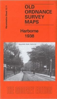
Harborne 1938 von Alan Godfrey Karte (gefalzt) 2017 | Alan Godfrey Maps ISBN: 9781787210448 Keine Verlagsinformationen verfügbar
Nantes - Angers Centenary Maps Karte (gefalzt) 2014 | Michelin Editions des Voyages ISBN: 9782067192263 CHF 17,65 (inkl. MwSt) Titel ist leider vergriffen; keine Neuauflage
Black’s Map of Scotland Picturesque Tourist Map 1840 von Adam Black; Charles Black; Collins Books Karte (gefalzt) 2017 | Collins ISBN: 9780008251154 Titel ist leider vergriffen; keine Neuauflage
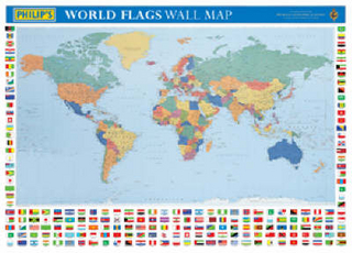
Philip's World Flags Wall Map Karte (gefalzt) 2003 | Philip's ISBN: 9780540083176 CHF 8,70 (inkl. MwSt) Titel ist leider vergriffen; keine Neuauflage
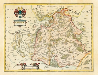
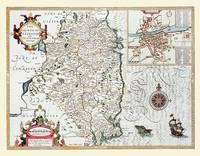
Historische Karte: WALDECK in Hessen 1635 (Plano) Kartuscheninschrift: Waldeck Comitatus von Johannes Janssonius Karte (plano) 2005 | Auflage: 1 | Verlag Rockstuhl ISBN: 9783937135144 CHF 29,15 (inkl. MwSt) Keine Verlagsinformationen verfügbar
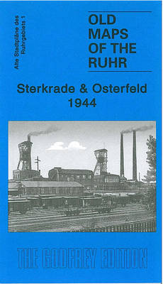
Sterkrade and Osterfeld 1944 Ruhr Sheet 1 von Alan Godfrey Karte (gefalzt) 2009 | Alan Godfrey Maps ISBN: 9781847843326 CHF 8,30 (inkl. MwSt) Keine Verlagsinformationen verfügbar
John Speed's County Map of Leinster 1611 Colour Laminated Print of County Map of Leinster 1611 von John Speed Karte (gerollt) 2010 | Historical Images Ltd ISBN: 9781844916733 CHF 66,30 (inkl. MwSt) Keine Verlagsinformationen verfügbar
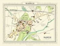
Map of Warwick 1898 Photographic Print of Map of Warwick 1898 von John Bartholomew Karte (plano) 2010 | Mapseeker Archive Publishing ISBN: 9781844916320 CHF 38,40 (inkl. MwSt) Keine Verlagsinformationen verfügbar
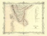
H Collins Map of Southern India 1852 Colour Photographic Print of Map of Southern India 1852 von H. Collins Karte (plano) 2010 | Mapseeker Archive Publishing ISBN: 9781844916979 CHF 34,90 (inkl. MwSt) Keine Verlagsinformationen verfügbar
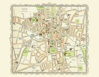
Map of Cheltenham 1898 Colour Print of Map of Cheltenham 1898 von John Bartholomew Karte (plano) 2010 | Mapseeker Archive Publishing ISBN: 9781844916429 CHF 22,65 (inkl. MwSt) Keine Verlagsinformationen verfügbar
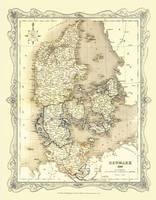
H Collins Map of Denmark 1852 Colour Photographic Print of Map of Denmark 1852 von H. Collins Karte (plano) 2010 | Mapseeker Archive Publishing ISBN: 9781844916832 CHF 34,90 (inkl. MwSt) Keine Verlagsinformationen verfügbar
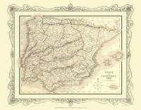
H Collins Map of Spain and Portugal 1852 Colour Photographic Print of Spain and Portugal 1852 von H. Collins Karte (plano) 2010 | Mapseeker Archive Publishing ISBN: 9781844916993 CHF 34,90 (inkl. MwSt) Keine Verlagsinformationen verfügbar
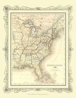
H Collins Map of United States 1852 Colour Photographic Print of Map of United States 1852 von H. Collins Karte (plano) 2010 | Mapseeker Archive Publishing ISBN: 9781844917044 CHF 38,40 (inkl. MwSt) Keine Verlagsinformationen verfügbar
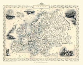
John Tallis Map of Europe 1851 Colour Print of Map of Europe 1851 by John Tallis von John Tallis Karte (plano) 2010 | Mapseeker Archive Publishing ISBN: 9781844913800 CHF 22,65 (inkl. MwSt) Keine Verlagsinformationen verfügbar
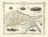
John Tallis Map of Northern India 1851 Colour Print of Northern India by John Tallis 1851 von John Tallis Karte (plano) 2010 | Mapseeker Archive Publishing ISBN: 9781844913190 CHF 22,65 (inkl. MwSt) Keine Verlagsinformationen verfügbar