Gannat / Menat Karte (gefalzt) 2017 | Institut Geographique National ISBN: 9782758539230 CHF 25,25 (inkl. MwSt) Versand in 3-4 Wochen
Cognac / Jarnac Karte (gefalzt) 2017 | Institut Geographique National ISBN: 9782758539438 CHF 25,25 (inkl. MwSt) Versand in 3-4 Wochen
Lamotte-Beuvron / Neung-sur-Beuvron Karte (gefalzt) 2017 | Institut Geographique National ISBN: 9782758539209 CHF 25,25 (inkl. MwSt) Versand in 3-4 Wochen
Stenay / Sivry-sur-Meuse Karte (gefalzt) 2017 | Institut Geographique National ISBN: 9782758539698 CHF 25,25 (inkl. MwSt) Versand in 3-4 Wochen
Noord-Brabant Middle bicycle junction maps Karte (gefalzt) 2020 | ANWB BV, Netherlands ISBN: 9789018046941 CHF 23,85 (inkl. MwSt) Versand in 10-14 Tagen
French South Karte (gefalzt) 2020 | Michelin Editions des Voyages ISBN: 9782067200159 CHF 10,90 (inkl. MwSt) Versand in 10-14 Tagen
Barr / Le Howald / Villé / Hte Vallée de la Bruche wp Karte (gefalzt) 2020 | Institut Geographique National ISBN: 9782758550778 CHF 31,95 (inkl. MwSt) Versand in 3-4 Wochen
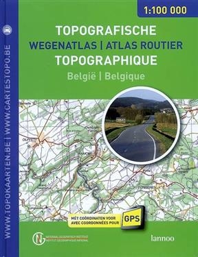
Atlas routier topographique Belgique, 1: 100.000 : avec coordonnées pour GPS. Wegenatlas.. Buch | Softcover 2008 | Lannoo ISBN: 9789020975758 jetzt vorbestellen Titel z.Zt. nicht lieferbar
Calderdale & South Pennines In the Yorkshire Pennines von Paul Hannon Buch | Softcover 2019 | Hillside Publications ISBN: 9781907626203 CHF 12,90 (inkl. MwSt) in den Warenkorb Versand in 10-20 Tagen
Meinweg hiking region map Karte (gefalzt) 2020 | ANWB BV, Netherlands ISBN: 9789018046736 CHF 23,85 (inkl. MwSt) Versand in 10-14 Tagen
Groningen South, Kop van Drenthe cycling map Karte (gefalzt) 2020 | ANWB BV, Netherlands ISBN: 9789018047092 CHF 23,85 (inkl. MwSt) Versand in 10-14 Tagen
Noordoostpolder cycling map Karte (gefalzt) 2020 | ANWB BV, Netherlands ISBN: 9789018047139 CHF 23,85 (inkl. MwSt) Versand in 10-14 Tagen
Waterland hiking region map Karte (gefalzt) 2020 | ANWB BV, Netherlands ISBN: 9789018046545 CHF 23,85 (inkl. MwSt) Versand in 10-14 Tagen
Noord-Brabant West hiking region map Karte (gefalzt) 2020 | ANWB BV, Netherlands ISBN: 9789018046668 CHF 23,85 (inkl. MwSt) Versand in 10-14 Tagen
Veluwezoom hiking region map Karte (gefalzt) 2020 | ANWB BV, Netherlands ISBN: 9789018046477 CHF 23,85 (inkl. MwSt) Versand in 10-14 Tagen
Groene Hart North hiking region map Karte (gefalzt) 2020 | ANWB BV, Netherlands ISBN: 9789018046637 CHF 23,85 (inkl. MwSt) Versand in 10-14 Tagen
Coast of Holland South hiking region map Karte (gefalzt) 2020 | ANWB BV, Netherlands ISBN: 9789018046613 CHF 23,85 (inkl. MwSt) Versand in 10-14 Tagen
Walcheren, Zuid-Beveland hiking region map Karte (gefalzt) 2020 | ANWB BV, Netherlands ISBN: 9789018046651 CHF 23,85 (inkl. MwSt) Versand in 10-14 Tagen
Flanders Zealand bicycle junction maps Karte (gefalzt) 2020 | ANWB BV, Netherlands ISBN: 9789018046996 CHF 23,85 (inkl. MwSt) Versand in 10-14 Tagen
Zuid-Holland East cycling map Karte (gefalzt) 2020 | ANWB BV, Netherlands ISBN: 9789018047276 CHF 23,85 (inkl. MwSt) Versand in 10-14 Tagen