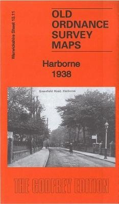
Harborne 1938 von Alan Godfrey Karte (gefalzt) 2017 | Alan Godfrey Maps ISBN: 9781787210448 Keine Verlagsinformationen verfügbar
Glasgow (High Street) 1895 Lanarkshire Sheet 6.11A von Gilbert Bell Karte (gefalzt) 2017 | Alan Godfrey Maps ISBN: 9781787210370 Keine Verlagsinformationen verfügbar
Bayonne - Tarbes Centenary Maps Karte (gefalzt) 2014 | Michelin Editions des Voyages ISBN: 9782067192294 CHF 17,65 (inkl. MwSt) Titel ist leider vergriffen; keine Neuauflage
Marseille - Cannes Centenary Maps Karte (gefalzt) 2014 | Michelin Editions des Voyages ISBN: 9782067192300 CHF 17,65 (inkl. MwSt) Titel ist leider vergriffen; keine Neuauflage
Nantes - Angers Centenary Maps Karte (gefalzt) 2014 | Michelin Editions des Voyages ISBN: 9782067192263 CHF 17,65 (inkl. MwSt) Titel ist leider vergriffen; keine Neuauflage
Paris - Chalons Centenary Maps Karte (gefalzt) 2014 | Michelin Editions des Voyages ISBN: 9782067192218 CHF 17,65 (inkl. MwSt) Titel ist leider vergriffen; keine Neuauflage
Quimper Centenary Maps Karte (gefalzt) 2014 | Michelin Editions des Voyages ISBN: 9782067192232 CHF 17,65 (inkl. MwSt) Titel ist leider vergriffen; keine Neuauflage
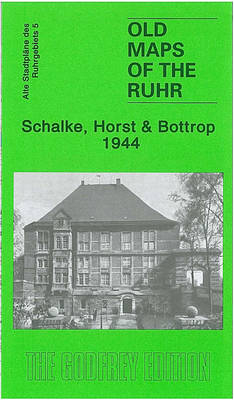
Schalke, Horst and Bottrop Ruhr Sheet 5 von Alan Godfrey Karte (gefalzt) 2009 | Alan Godfrey Maps ISBN: 9781847842237 CHF 14,65 (inkl. MwSt) Keine Verlagsinformationen verfügbar
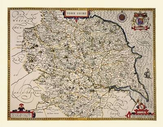
John Speed Map of Yorkshire 1611 20" x 16" Photographic Print of the County of Yorkshire - England von John Speed Karte (gerollt) 2010 | Historical Images Ltd ISBN: 9781844910182 CHF 38,40 (inkl. MwSt) Keine Verlagsinformationen verfügbar
Thomas Moules Map of Cambridgeshire 1837 Colour Print of County Map of Cambridgeshire 1837 by Thomas Moule von Thomas Moule Karte (plano) 2010 | Mapseeker Archive Publishing ISBN: 9781844913268 CHF 22,65 (inkl. MwSt) Keine Verlagsinformationen verfügbar
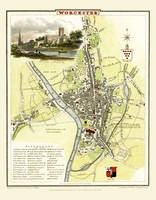
Cole and Roper Map of Worcester 1808 Colour Print of City of Worcester Plan 1808 by Cole and Roper von Cole and Roper Karte (plano) 2010 | Mapseeker Archive Publishing ISBN: 9781844912940 CHF 22,65 (inkl. MwSt) Keine Verlagsinformationen verfügbar
Archibold Fullarton's Laminated Poster Map of Birmingham 1866 Colour Laminated Poster Print Map of Birmingham 1866 by Archibold Fullarton von Archibold Fullarton Karte (gerollt) 2010 | Mapseeker Archive Publishing ISBN: 9781844914234 CHF 66,30 (inkl. MwSt) Keine Verlagsinformationen verfügbar
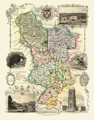
Thomas Moule Map of Derbyshire 1836 20" x 16" Photographic Print of the County of Derbyshire - England von Thomas Moule Karte (plano) 2010 | Mapseeker Archive Publishing ISBN: 9781844911158 CHF 38,40 (inkl. MwSt) Keine Verlagsinformationen verfügbar
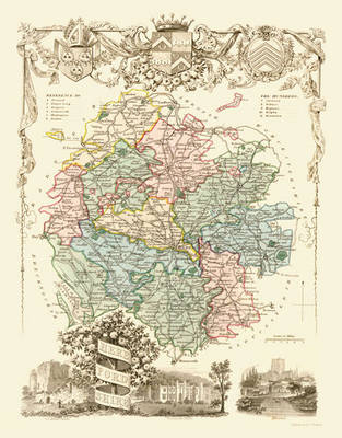
Thomas Moule Map of Herefordshire 1836 20" x 16" Photographic Print of the County of Herefordshire - England von Thomas Moule Karte (plano) 2010 | Mapseeker Archive Publishing ISBN: 9781844911233 CHF 38,40 (inkl. MwSt) Keine Verlagsinformationen verfügbar
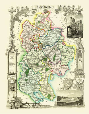
Thomas Moule Map of Bedfordshire 1836 20" x 16" Photographic Print of the County of Bedfordshire - England von Thomas Moule Karte (plano) 2010 | Mapseeker Archive Publishing ISBN: 9781844911097 CHF 38,40 (inkl. MwSt) Keine Verlagsinformationen verfügbar
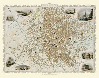
John Tallis Map of Birmingham 1851 20" x 16" Photographic Print of Birmingham von John Tallis Karte (plano) 2010 | Mapseeker Archive Publishing ISBN: 9781844910113 CHF 38,40 (inkl. MwSt) Keine Verlagsinformationen verfügbar
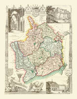
Thomas Moule Map of Monmouthshire 1836 20" x 16" Photographic Print of the County of Monmouthshire - Wales von Thomas Moule Karte (plano) 2010 | Mapseeker Archive Publishing ISBN: 9781844911356 CHF 38,40 (inkl. MwSt) Keine Verlagsinformationen verfügbar
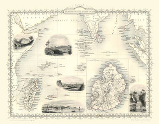
John Tallis Map of Indian Ocean Islands 1851 Photographic Print of the Islands in the Indian Ocean 1851 by John Tallis von John Tallis Karte (plano) 2010 | Mapseeker Archive Publishing ISBN: 9781844911738 CHF 34,90 (inkl. MwSt) Keine Verlagsinformationen verfügbar
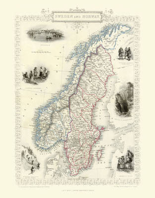
John Tallis of Map of Norway and Sweden 1851 Poster Print of Map of Norway and Sweden 1851 by John Tallis von John Tallis Karte (plano) 2010 | Mapseeker Archive Publishing ISBN: 9781844911868 CHF 34,90 (inkl. MwSt) Keine Verlagsinformationen verfügbar
John Speeds Map of Derbyshire 1611 Colour Print of County Map of Derbyshire 1611 by John Speed von John Speed Karte (plano) 2010 | Historical Images Ltd ISBN: 9781844912247 CHF 26,15 (inkl. MwSt) Keine Verlagsinformationen verfügbar